


Views
National Storm Overflow Hub – Three Months On
It has been three months since Water UK launched the National Storm Overflow Hub – an interactive map showing the operation of every storm overflow in England. Maps showing data on storm overflows for Wales and Scotland are also available to browse.
Every water and sewerage company in England was legally required to produce its own real time overflow map and these were all published ahead of the 2025 deadline. The National Storm Overflow Hub was a voluntary commitment made by Water UK in 2023 in recognition of the public’s demand for ever greater transparency. The Hub brings together all the data from the English regional maps in one place.
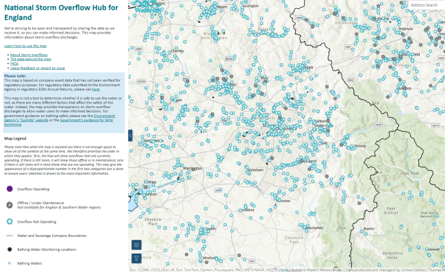
For the first time anywhere in the world the public can see when, where and for how long a storm overflow has been active in near real time. The Hub also includes an FAQ section that provides users with important information about storm overflows and how the water industry manages them.
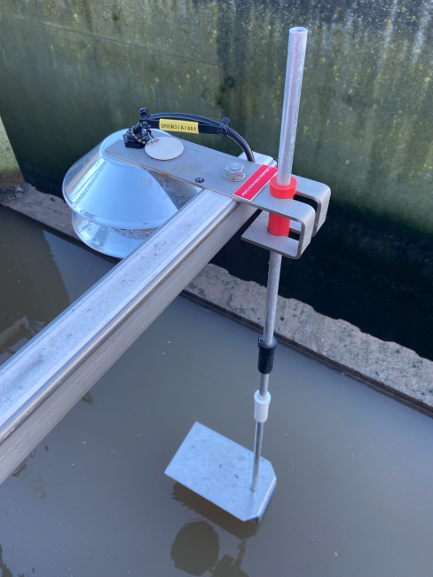
No other country in the world makes this data publicly available in this way. In fact, many other countries don’t even know how many storm overflows they have. The map has been made possible because every permitted storm overflow in England and Wales is fitted with an Event Duration Monitor (EDM).
The Hub is also fully open source, meaning activists, campaigners, charities and academics can access an Application Programming Interface (API) and use the data for their own purposes. As of now, the Surfers Against Sewage ‘Sewage Data HQ’ and The Rivers Trust ‘Sewage Map’ both use this API for their own maps while other maps like sewagemap.co.uk, use data from the Hub.
Since its launch in November, the National Storm Overflow Hub has been viewed almost 15,000 times but thousands more are accessing this data via other maps on a daily basis.
Beyond the Hub, our National Storm Overflows Plan for England details more than 9,000 improvements that companies are going to make over the next 25 years to improve individual overflows. Anyone can use this interactive map to find out when and how individual overflows will be improved and when they will meet Government targets, if they haven’t done so already.
The public can now access an unprecedented level of data about water companies in England and Wales. Information on everything from leakage to environmental performance is available on the Discover Water website. Later this year water companies will also begin to install ‘continuous water quality monitors’ which will provide data on water temperature, pH values, dissolved oxygen levels, turbidity and ammonia. In addition, companies are starting to roll out monitoring for emergency overflows with 100% to be monitored by 2035.
While this additional monitoring will take time, the data gained will provide even more insight into water company performance, and, particularly in the case of continuous water quality monitoring, could point to other sources of pollution and what more can be done to protect the environment.
All this data not only informs people but also helps water companies to direct investment to where it is most needed. A record £104 billion will be invested over the next five years to support economic growth, secure our water supplies and end sewage entering our rivers and seas. This investment will see our water sector, already one of the most open in the world, become even more transparent and we look forward to continuing using the new data to build a better understanding of how the water industry is tackling environmental challenges.
Share